30A Beach Flag Forecast – 5-Day Predictions
Scenic Highway 30A runs along Florida's Emerald Coast in South Walton County, between Destin and Panama City Beach. Its beach communities include Dune Allen Beach, Blue Mountain Beach, Grayton Beach, WaterColor, Seaside, Seagrove Beach, Alys Beach, Rosemary Beach and Inlet Beach.
Our goal is to forecast the beach flag conditions along 30A several days in advance using weather, marine and historical data.
Today's 30A Beach Flag Prediction


Yellow means moderate surf and/or currents -- use caution in the Gulf. Purple indicates dangerous marine life may be present.
30A Beach Flag Forecast – Next 5 Days
| Date | Flag | Predicted Conditions | Confidence |
|---|---|---|---|
| Sep 24, 2026 | |
Yellow + Purple | 96% |
| Sep 25, 2026 | |
Yellow + Purple | 95% |
| Sep 26, 2026 | |
Yellow + Purple | 95% |
| Sep 27, 2026 | |
Yellow + Purple | 95% |
| Sep 28, 2026 | |
Yellow + Purple | 94% |
How We Predict 30A Beach Flags
Beach flags at South Walton beaches are set by the South Walton Fire District's Beach Safety staff, based on the surf and current conditions they observe at the beach, and are typically updated twice a day.
Our model combines weather forecasts (wind speed and direction, rain and temperatures) with marine forecasts for the Gulf just off 30A (wave height, wave period and swell) and the most recent official flag, compared against years of historical flag outcomes, to estimate the most likely flag color for each of the next five days. Wave conditions are the strongest single driver of flag decisions, which is why they carry the most weight in the model.
The "confidence" figure is the probability our model assigns to the predicted flag color, adjusted slightly downward based on how our past forecasts actually performed. It is highest when conditions are clearly calm or clearly rough, and lower when the Gulf is close to the threshold between two flag colors. The forecast is regenerated every day with the latest data.
About Florida's Beach Flag Warning System
Florida's color-coded beach flag system was adopted statewide to give beachgoers a quick, consistent way to gauge water hazards without needing to read a full surf report. Most coastal counties, including Walton County, use the same five-color scale (see below for what each color means).
In South Walton, flags are physically raised at staffed beach accesses and are checked and updated through the day by lifeguards as conditions change -- a beach can move from yellow to red, for instance, if a squall line moves through in the afternoon. Because conditions can also vary somewhat from one public beach access to the next along the 30A corridor, the flag at your specific beach can differ slightly from the general forecast above.
What Do the 30A Beach Flags Mean?
 Double Red Flag:
Water closed to the public.
Red Flag:
High hazard.
Yellow Flag:
Medium hazard.
Double Red Flag:
Water closed to the public.
Red Flag:
High hazard.
Yellow Flag:
Medium hazard.
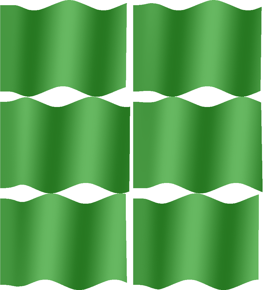 Green Flag:
Low hazard.
Purple Flag:
Dangerous marine life.
Green Flag:
Low hazard.
Purple Flag:
Dangerous marine life.
30A Jellyfish & Purple Flag Conditions
Recent jellyfish sightings and stings have been reported along parts of 30A and nearby Emerald Coast beaches. Jellyfish conditions can change quickly and may vary considerably from one beach to another.
A purple flag indicates dangerous marine life. Jellyfish are one possible reason for a purple flag, but a purple flag does not necessarily mean that jellyfish are present.
Our jellyfish page includes recent community reports and an interactive map covering 30A, Miramar Beach, Destin, Fort Walton Beach, Navarre and nearby Emerald Coast beaches.
View Latest 30A Jellyfish Reports & Map →30A Beach Water Quality
Check the latest official water-quality results for all 9 monitored Walton County locations, including recent Enterococcus samples and an interactive map.
The page makes it easy to compare current Good, Moderate or Poor results and review the five most recent samples for each monitored location.
View 30A Beach Water Quality →30A Restaurant Recommendations
See which restaurants the 30A community recommends most, based on real recommendations rather than paid placements, with an interactive map and what people suggest ordering.
View 30A Restaurant Recommendations →30A Crowd Forecast 2026 – Best Time to Visit 30A
Wondering when 30A is least crowded? Our experimental 2026 crowd forecast compares expected visitor pressure day by day throughout the year, including quieter weekdays, busy summer periods and major holiday weekends.
Use the full 30A crowd calendar to compare travel dates and identify less crowded times to visit 30A Florida.
View the 2026 30A Crowd Forecast & Crowd Calendar →Where Is 30A?
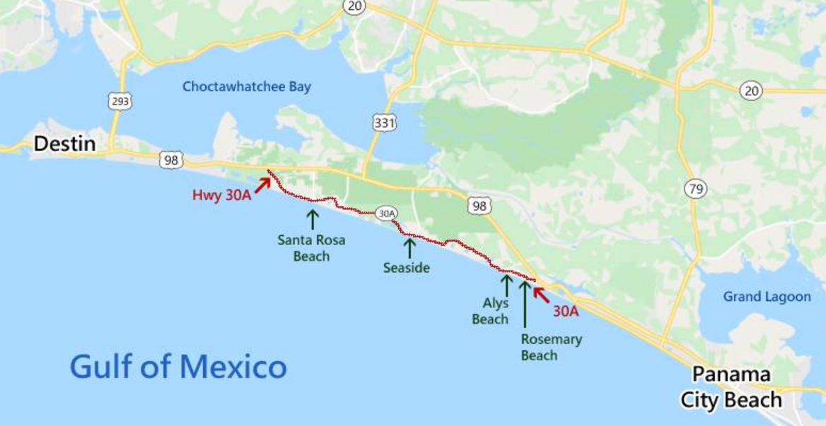
Scenic Highway 30A is an 18.7-mile stretch of two-lane coastal road in South Walton County, Florida, running roughly between Dune Allen Beach in the west and Inlet Beach in the east, connecting to US-98 at both ends between Destin and Panama City Beach. Unlike a single town, 30A is a chain of distinct small beach communities, each with its own character, dune-lake access points and public beach accesses, so flag conditions and crowd levels can genuinely differ from one community to the next on the same day.
Moving roughly west to east along the highway: Dune Allen Beach and Santa Rosa Beach anchor the western end, close to several of 30A's coastal dune lakes. Blue Mountain Beach sits on one of the highest natural points on the Gulf Coast. Grayton Beach is the oldest of the 30A communities and borders Grayton Beach State Park. WaterColor and Seaside are master-planned New Urbanist communities -- Seaside was the first of its kind on 30A and is built around a central town square. Seagrove Beach lies between Seaside and Alys Beach, with a mix of older cottages and newer development. Alys Beach is known for its white Bermuda-style architecture, and Rosemary Beach for its boardwalks and Caribbean-influenced design. Inlet Beach marks the eastern end of 30A, near the inlet connecting the Gulf to Lake Powell, one of the largest coastal dune lakes in the country.
About 30A Beach Flag Predictions
30A Beach Flag Predictions is a private project run by data scientists interested in weather, tourism and beach conditions along Scenic Highway 30A.
Our forecasts are independent predictions and are not affiliated with Walton County, South Walton Fire District or any other local authority. They should never replace official beach flags or lifeguard instructions. Always exercise caution in the Gulf regardless of the predicted or official flag color.
Frequently Asked Questions
What is the beach flag today on 30A?
The homepage above shows today's predicted flag color, updated daily using an independent machine-learning model based on weather, marine and historical data. This is a prediction, not the official flag status -- always confirm with the flags actually flying at your beach.
Is this the official Walton County beach flag status?
No. 30A Beach Flag Predictions is an independent data-science project and is not affiliated with Walton County, the South Walton Fire District, or any local authority. Always check the flags currently flying at the beach and follow lifeguard instructions.
What does a purple flag mean on 30A?
A purple flag indicates dangerous marine life may be present. Jellyfish are one possible reason for a purple flag, but a purple flag does not necessarily mean jellyfish are present.